

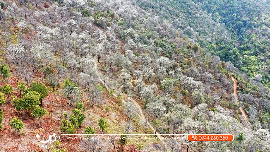
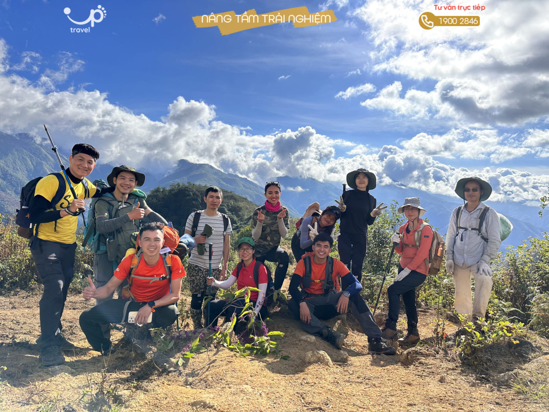
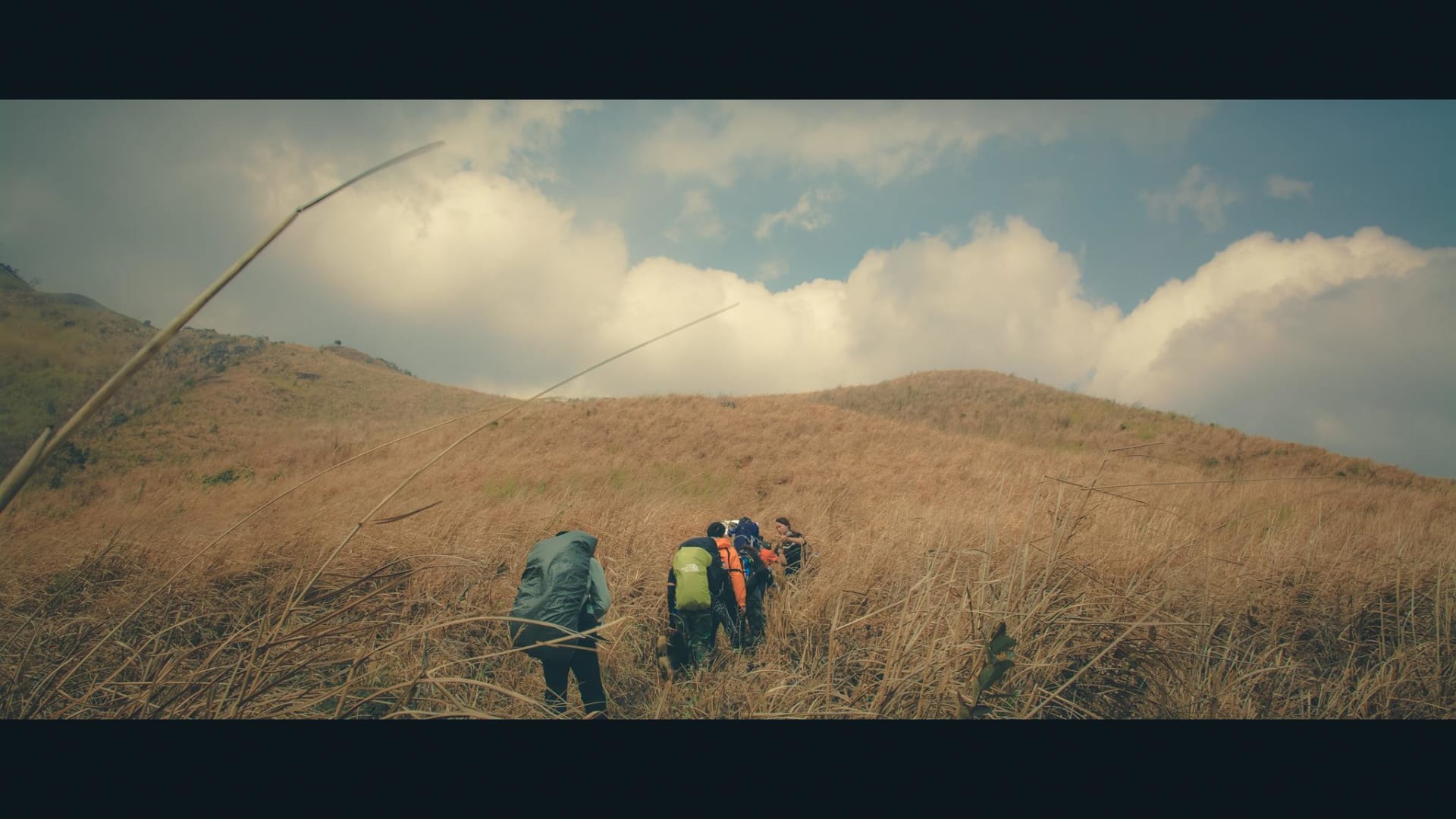
TOUR LEO NÚI TÀ CHÌ NHÙ – VƯƠNG QUỐC SƠN TRA Tà Chì Nhù hướng Nậm Nghiệp, lâu nay các trekker đều hình dung về một thảo nguyên trơ trọi với biển mây ngập tràn xuất phát từ hướng Trạm Tấu – Yên Bái. Tuy nhiên, với con đường mới do Travel Up khai thác […]
07
Nov
Nov
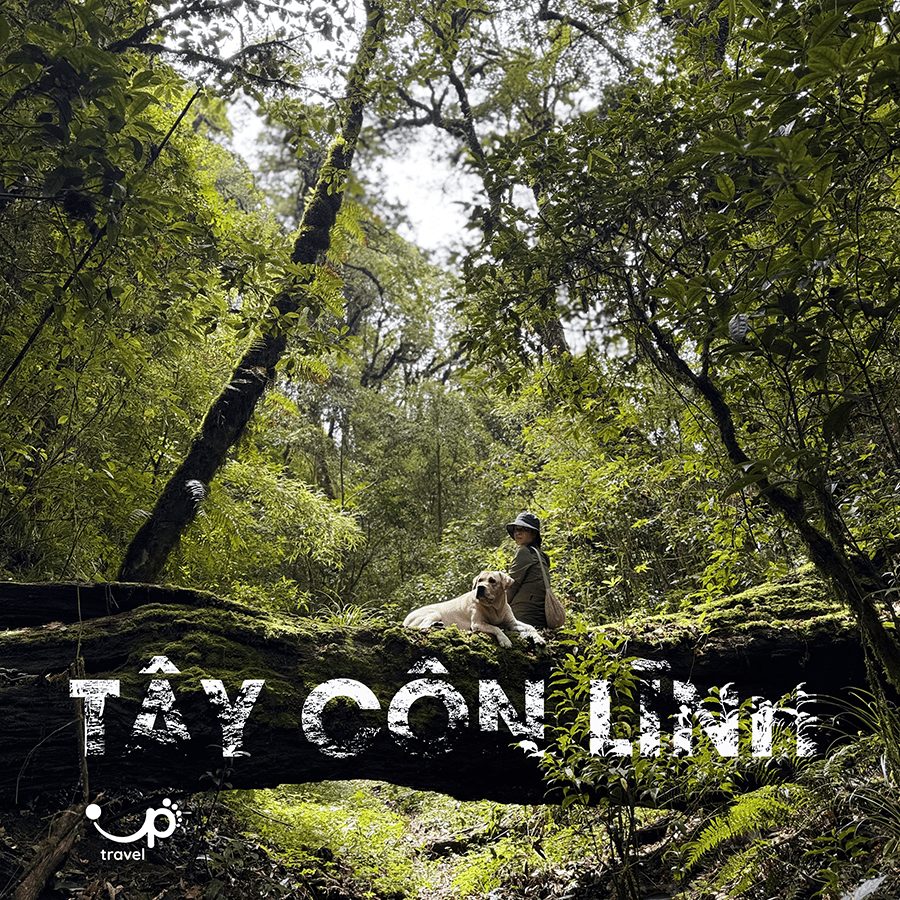
TOUR TREKKING TÂY CÔN LĨNH – HÀ GIANG 2 NGÀY 3 ĐÊM Núi Tây Côn Lĩnh Hà Giang – ngọn núi cao nhất vùng Đông Bắc với độ cao 2.427m – là điểm đến không thể bỏ qua trong hành trình tour trekking Tây Côn Lĩnh 2 ngày 3 đêm. Được mệnh danh là “nóc […]
14
Feb
Feb
THE EAST POLE: DIFFICULT LEVEL 4/10
The trekking length of 14 km overcomes many types of terrain such as: sandy desert, stream, shrub forest, unspoiled coastline,…
Tour duration: 2 days and 2 nights
14
Feb
Feb
PU LUONG: DIFFICULTY LEVEL 3/10 · EASY
Tour duration: 2 days and 1 night
Activities: Visiting Mu Waterfall, Deer Waterfall, Co Lung duck… Light hiking for 3km in forest trail with no slopes.
Resort with swimming pool
Suitable for families, agencies and organizations to go on vacation with light exercise
14
Feb
Feb
PUSILUNG: DIFFICULTY LEVEL 9/10 · VERY HARD
PUSILUNG: 3083 m high, Pa Ve Su – Muong Te – Lai Chau
Duration: 3 days and 4 nights
Trekking over 60 km of forest and mountain trails, the terrain involves cyperus Iria and bamboo with many streams along the way
There has been no shack to stay in. We shall prepare tents instead
14
Feb
Feb
NAM KANG HO TAO: DIFFICULTY LEVEL 9/10 · VERY HARD
NAM KANG HO TAO: 2881m high. The trek starts from Thao A village – Lai Chau, through Hoang Lien Son national forest, and ends at Seo Mi Ty – Sapa – Lao Cai
Tour duration: 3 days and 4 nights
Trekking through 40km of mountain and forest trail, of which the national park’s terrain involves many old forests, steep slopes and quite dangerous cliffs
Sleep in tents
14
Feb
Feb
KHANG SU VAN: DIFFICULTY LEVEL 9/10 · VERY HARD
Khang Su Van: 3012m high, Pa Vai Su commune, Phong Tho district, Lai Chau province
tour duration: 3 days and 4 nights
Forest trails, steep terrain, few streams
Sleeping in tents at an altitude of 2600m

14
Feb
Feb
PO MA LUNG: DIFFICULTY LEVEL 9/10 · VERY HARD
PO MA LUNG: 2967m high, Ban Lang – Lai Chau
Tour duration: 3 days and 4 nights
Trekking over 35 km of mountain trails, with the terrain involving many old forests, super beautiful waterfalls, and streams
Sleeping in a shack at an altitude of 2500m
14
Feb
Feb
PAVI ANCIENT STONE ROAD: DIFFICULT LEVEL 5/10 – EASY
Duration: 3 days and 4 nights
Trekking through 32km of mountain trails with many forests and streams
Trails and paved roads through old forests and ethnic villages
Sleep in a shack at an altitude of 1800m
14
Feb
Feb
LUNG CUNG: DIFFICULTY LEVEL 6/10 · MODERATE
LUNG CUNG: 2925m high, Tu Le – Yen Bai
Tour duration: 2 days and 3 nights
Trekking through 19km of mountainous and forested terrain. Potential for cloud hunting
Sleeping in a shack at an altitude of 2500m
02
Dec
Dec
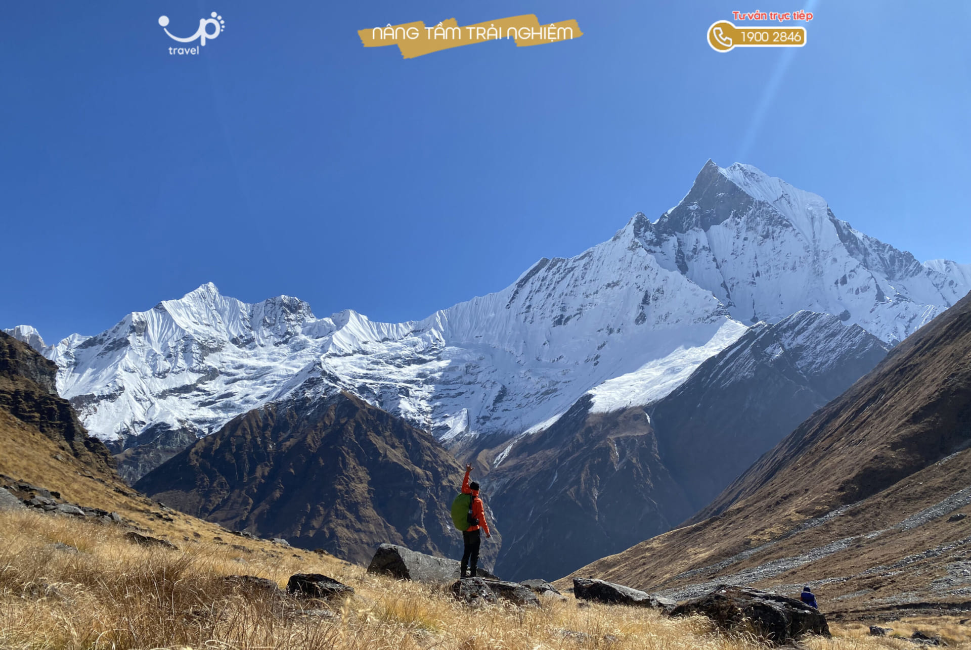
ANNAPURNA BASE CAMP:
ANNAPURNA BASE CAMP: Cao 4130m
Vị trí: NEPAL
Thời lượng: Tour 10 ngày
Đường rừng núi, địa hình dốc nhẹ, đi qua nhiều địa hình khác nhau
Ngủ tại TeaHouse của người bản địa.
HDV Việt Nam
22
Sep
Sep
NHIU CO SAN: DIFFICULTY LEVEL 7/10 · MODERATE
NHIU CO SAN: 2965m high, Trung Leng Ho – Bat Xat – Lao Cai
Tour duration: 2 days and 3 nights
Trekking through 19 km of forest trails, with the main terrain being many old forests. Visit Ong Chua waterfall and the potential for cloud hunting
Sleeping in a shack at an altitude of 2500m

22
Sep
Sep
TA XUA: Level 8/10 · HARD
TA XUA: 2865m high, Ho Thau – Ban Cong – Tram Tau – Yen Bai
Tour duration: 3 days and 4 nights
Over 34km of mountain road, many forest, few streams. Suitable for hunting clouds and watching majestic landscapes.
22
Sep
Sep
NGU CHI SON: DIFFICULTY LEVEL 7/10 · MODERATE
NGU CHI SON: 2,858m high. Ta Giang Phinh – Sapa – Lao Cai
Tour duration: 2 days and 3 nights
Trekking through 9 km of forest trails with steep terrain and a lot of cliffs. There is potential for cloud hunting
Sleeping in a shack at an altitude of 2600m

22
Sep
Sep
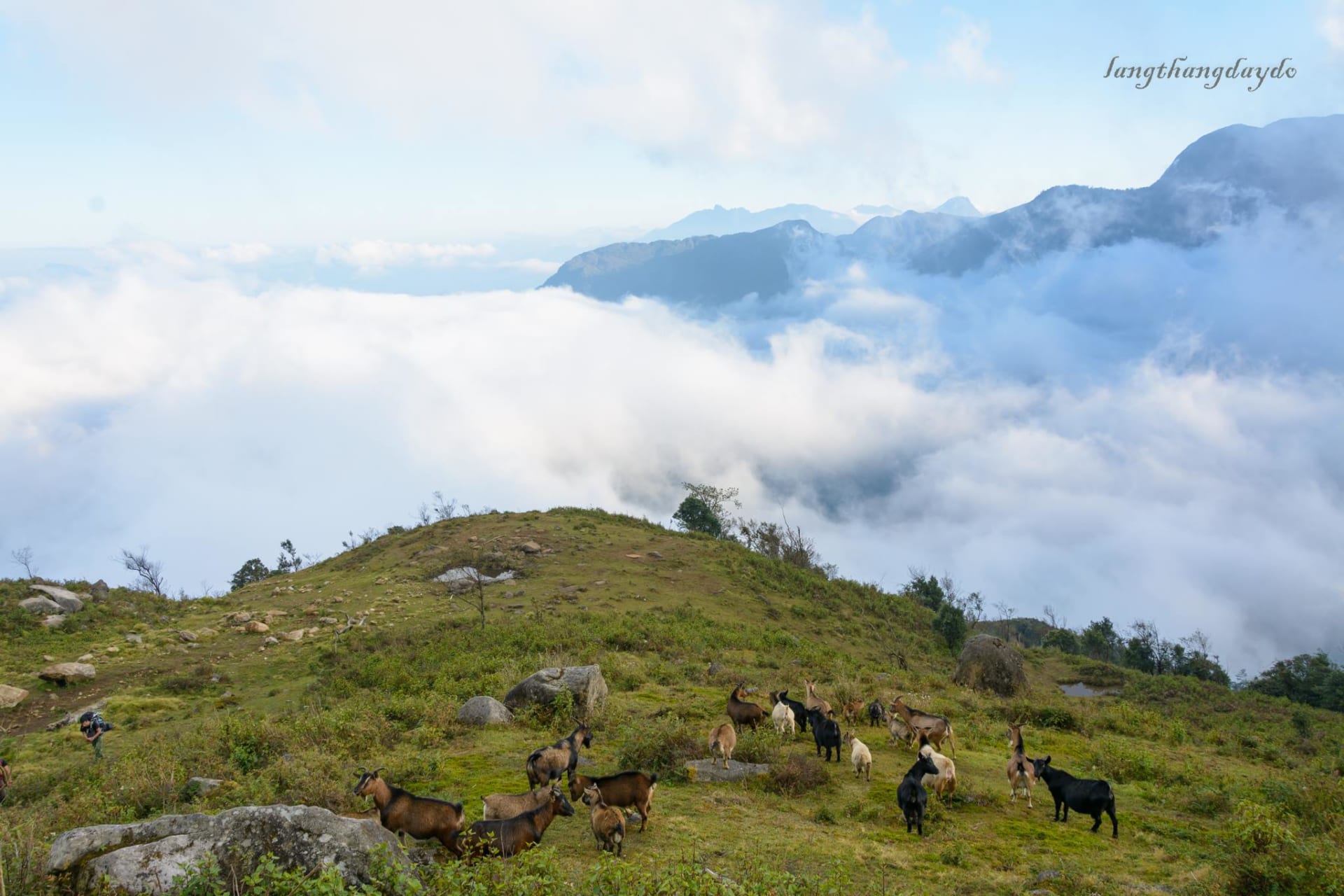
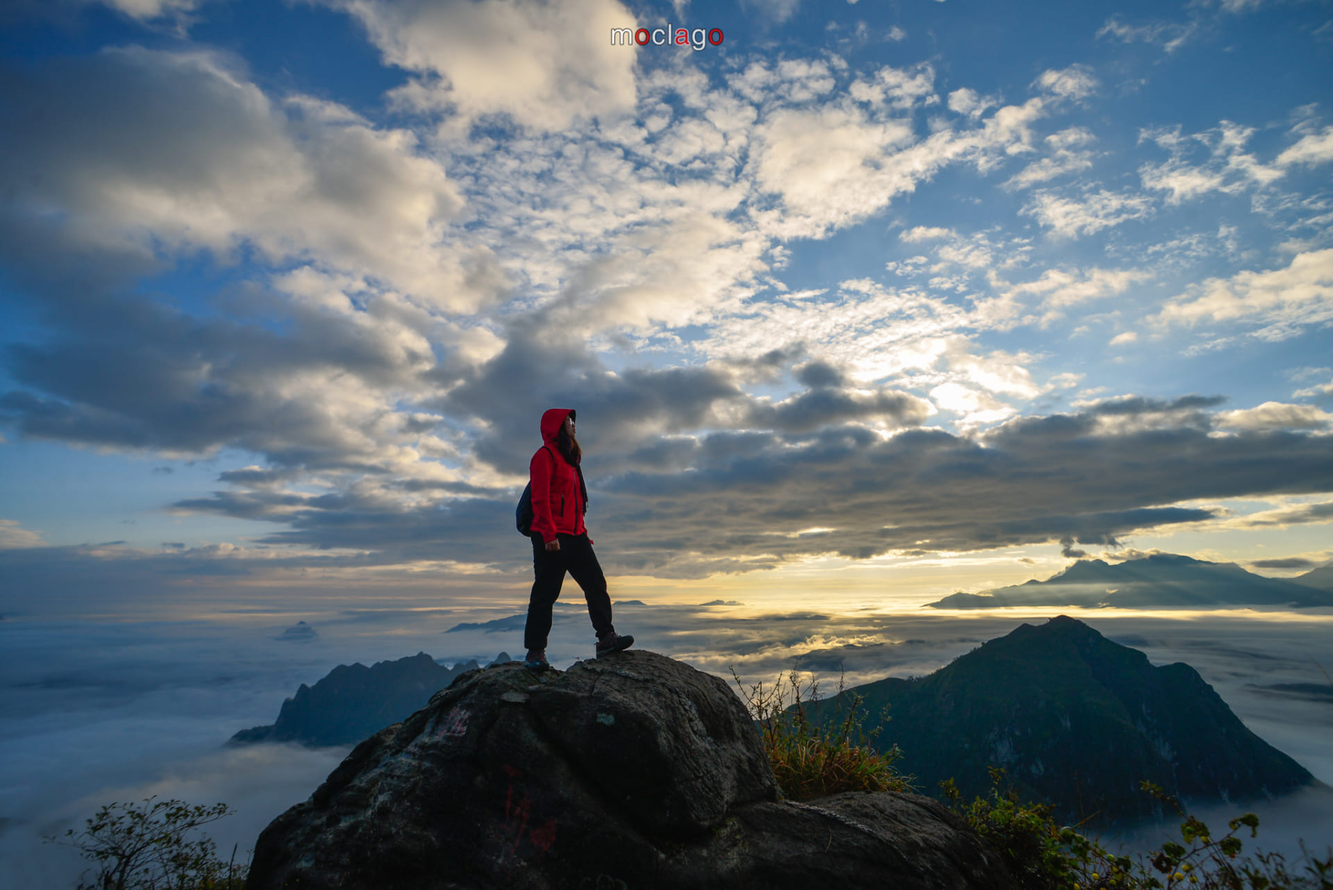
Some tell that Vietnamese are “Cloud Hunters”, referring to how Vietnamese love the view of magnificent ocean of cloud. And that’s why so many of us come to Ta Chi Nhu, a true paradise located in the Northwest of Vietnam. With the height of 2.979 meters above sea level for the summit, plus the high slopes and the strong windblow due to its airy location, it will not be easy for everybody to conquer.
Instead, you will be provided a 360 degree viewing angle, giving you the feeling of standing on top of the world. The clouds, the howling wind, the dreamy purple of unnamed wildflowers growing along the mountain spine,… those must be the precious of a true wanderlust soul
22
Sep
Sep
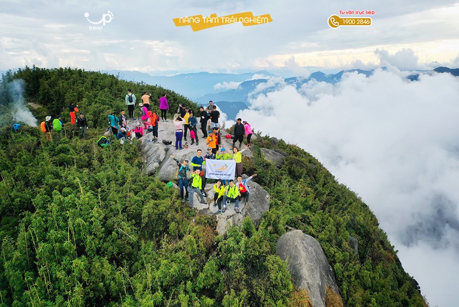
When the reputation of the legendary Fansipan faded away, BACH MOC LUONG TU appears and become the first choice to replace that position. Located on the line between Lai Chau and Lao Cai, Bach Moc is famous for its exquisite scene containing a heaven of cloud. While beautiful cloud only exist in about 10 days in Fansipan, the heaven of cloud in Bach Moc Luong Tu remains continually the whole year.
The multi-terrain in Bach Moc is not for the amateurs. It is a difficulty, but also be a gift for those who are determined to conquer the composing mountain. With good health and endurance, you will have a chance to pass the winding road, go through the thick forest covered by dew, climb up the sloping cliffs to the impressive saddle, have a good dream underneath the mysterious night sky. These things are the special gifts for anyone can conquer one of the most impediment mountains in Viet Nam.
It must be an UNFORGETTABLE experience that you will ever have!
- 1
- 2